

This is a Google map showing the flow of water from St. Mary's Falls all the way to the Atlantic Ocean.
Use the +/- buttons in the bottom right to zoom in to where we hiked (look for the colored markers).
Here is a 360 view of St. Mary's Falls. Click and drag to look around!
This is a 3-D model of St. Mary's Falls. You can zoom in and spin it around.
The trailhead is marked with the hiker, and the falls is marked with the red pin.
Created with 3-D Mapper.


Social Studies
VS.2 (2015) The student will demonstrate an understanding of the relationship between physical geography and the lives of the native peoples, past and present, of Virginia by
b) locating and describing Virginia’s Coastal Plain (Tidewater), Piedmont, Blue Ridge Mountains, Valley and Ridge, and Appalachian Plateau;
VS.1 (2023) The student will apply history and social science skills to explain the relationship between physical geography and the lives of Virginia’s peoples, past and present by
b. locating and describing the relative location and physical characteristics of Virginia's five geographic regions on a map; and
c. locating, identifying, and describing the impact of Virginia’s bodies of water on its history, economy, and culture.
Science
K.4 The student will investigate and understand that water is important in our daily lives and has properties. Key ideas include
a) water has many uses;
b) water can be found in many places;
c) water occurs in different phases; and
d) water flows downhill.
4.8 The student will investigate and understand that Virginia has important natural resources. Key resources include
a) watersheds and water;
b) plants and animals;
c) minerals, rocks, and ores; and
d) forests, soil, and land.
5.8 The student will investigate and understand that Earth constantly changes. Key ideas include
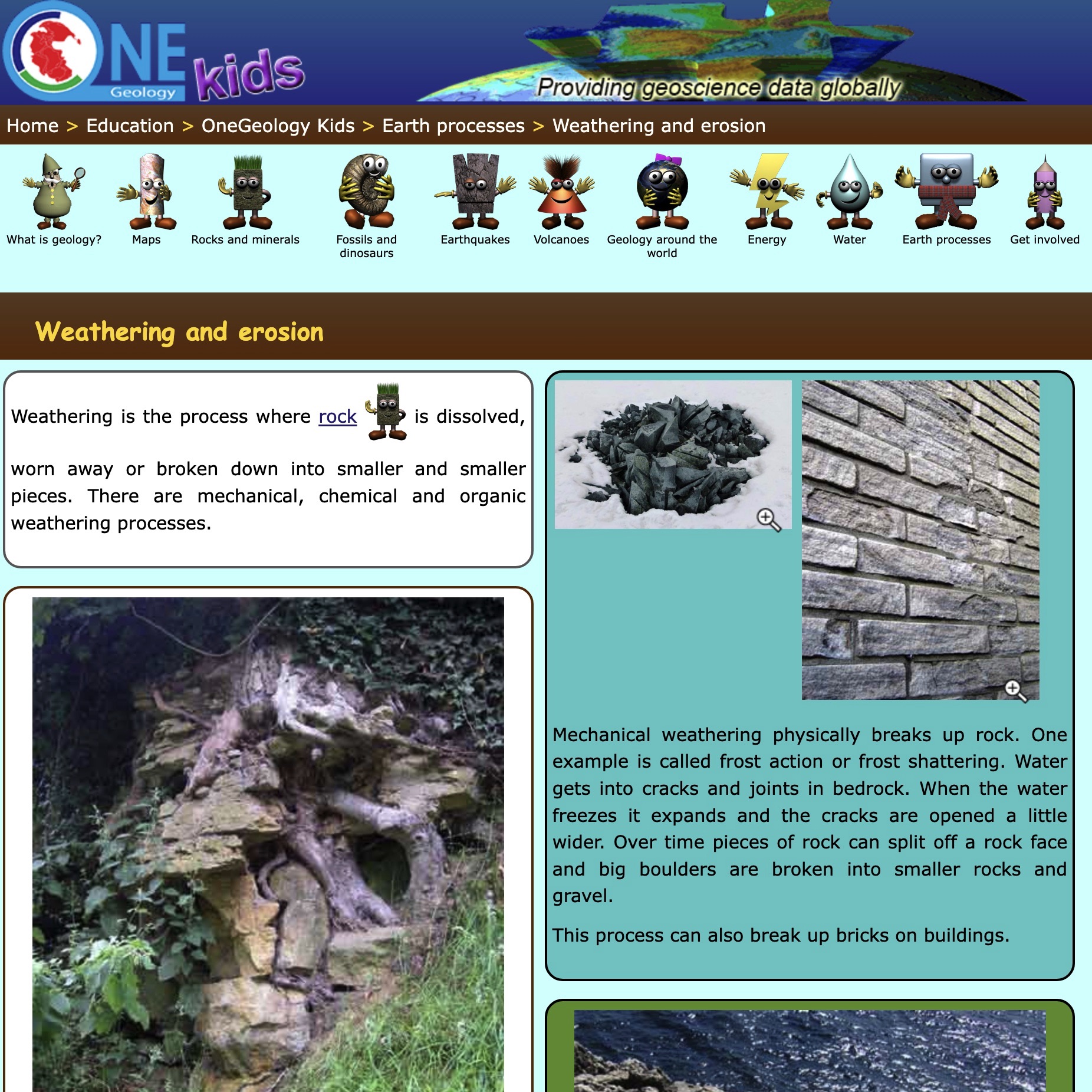
d) processes such as weathering, erosion, and deposition change the surface of the Earth;